John Muir wrote the often-quoted line “the mountains are calling and I must go ...” in a letter to his sister Sarah Muri Galloway.
Going to the mountains wasn’t that hard of a challenge for the man who incessantly studied, hiked, climbed, documented and wrote about the California wilderness and founded the Sierra Club.
There are at least 170 mountain ranges in California.
Depending upon the parameters one uses there are those that placed the number at 352 “intertwining mountain ranges.”
California has a lot of mountain ranges because of its relatively short time as part of the earth’s crust defined in geological times. They were forged and sculptured by volcanoes, earthquakes, and glaciers.
Regardless the number, we clearly take what mountains we have — as well as deserts, rugged coastline, sandy beaches, and fertile valleys — for granted.
That hit home eight years ago.
Moses Durante, a friend of my grandson Rein, was visiting from Georgia.
As they brought him to Manteca from San Francisco International Airport, they crossed the Altamont Pass at 1,009 feet.
Moses, was literally stunned that California had mountains that high.
Georgia has its share of mountains including the tallest peak known as Cold Mountain at 6,030 feet.
Like many first-time visitors to California, the assumption is that the Golden State is just one long beach bookended by San Diego and San Francisco.
Four days later when I took Moses on a hike to Yosemite National Park, he stood on North Dome at 7,546 feet mesmerized by Half Dome across Tenaya Canyon.
After a minute or so, he turned and said eight words I’ll remember forever, “You’re lucky, I’ve never been this high before.”
I found it amusing on two levels.
The double entendre escaped him.
Moses, like many young men, occasionally partakes in marijuana.
I half-jokingly asked if that included any buzz he may have gotten from marijuana.
“Definitely,” came the reply without missing a beat.
Then he asked how high could you go on a hike in California.
I told him 14,505-feet, or just about twice as high as we were at that moment.
When I told him I had summited Mt. Whitney four times, he couldn’t believe I lived in a state with a mountain that high that you could hike to the top of.
Of course, Mt. Whitney is the highest point in the lower 48 states.
It is one of a dozen “true” 14ers — mountain peaks over 14,000 feet. There are actually 15 peaks over 14,000 feet but the other three don’t qualify given they don’t have at least 300 feet of prominence.
In some quarters I’d be called a low-key “peak freak”.
It’s a moniker given to those that make it a goal to hike to the summits of mountain peaks. If you count repeat trips to some summits, I’ve peaked perhaps 50 or so mountains.
I absolutely love the mountain ranges ringing Death Valley — the Funerals, the Argus Range, Black Mountains and the Panamint Range. There are endless points where you can look out from ridges and peaks and see what for what seems like forever.
As mountain aficionados go, I’m far from being anywhere near the class of more than a few people I’ve come across on hikes over the years.
That said, I do believe people are missing the boat when they don’t answer the call that Muir did, especially if they live in the Great Central Valley.
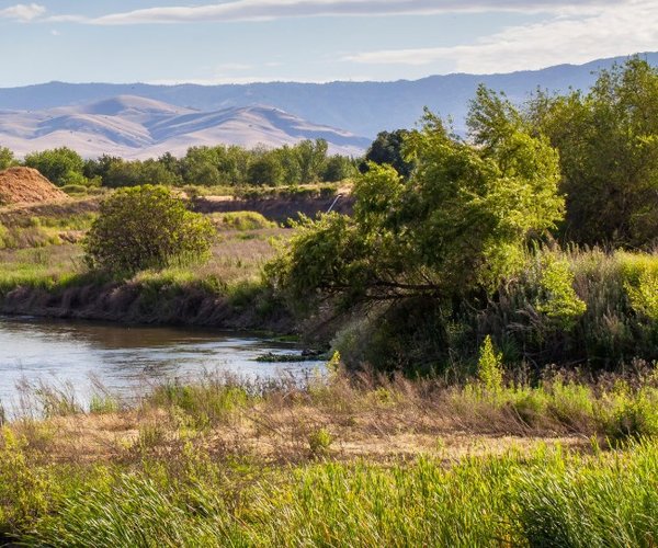
The Central Valley — Sacramento Valley on the north and San Joaquin Valley to the south of the Delta — is 450 miles long and varies from 30 to 60 miles in width.
Except for where the Delta exposes it to the San Francisco Bay and beyond, it is all ringed by mountain ranges.
The forces that created the valley is why we have arguably the world’s most fertile farmland, the unique “tule” fog, as well as some of the nation’s worst air quality at times.
And since we can see at least two of the mountain ranges on most days from the Northern San Joaquin Valley, it wouldn’t hurt to know a little bit more about what is literally in our own backyard.
The four primary ranges are the Sierra to the east, the Coastal to the west, the Cascades to the north, and the Tehachapi Mountains to the south.
What many refer to as the Altamont Hills is a part of Diablo Range that runs parallel to the Coastal Range
It stretches 180 miles south from the edge of the Carquinez Strait to Polonio Pass near the Salinas Valley area. It is 20 miles wide at its widest point.
It is bordered on the northeast by the San Joaquin River and on the northwest by the Santa Clara Valley.
It is paralleled on the east by Interstate 5 and on the west by Highway 101.
San Benito Mountain is its tallest peak at 5,241 feet.
The must-do peak that you can drive to the top of is Mt. Diablo at 3,848 feet. You can also hike or bicycle it as well.
There’s a visitors center with an observation deck at the top that provides sweeping views of the Delta, the Sierra, and parts of the Northern San Joaquin Valley.
The Coastal Range is actually two ranges; one north and one south of the San Francisco Bay.
It runs 400 miles from Del Norte in Humboldt County to Santa Barbara. There are three other ranges that are grouped with the Coastal Range — the Transverse Range, the Peninsular Range, and the Klamath Mountains.
Mount Linn at 8,098 feet is the highest point in the Coastal Range.
Although it is not a peak per se, Big Sur is the go-to point in the Coastal Range.
It clings to the rugged coastline of the Coastal in an unparalleled meeting of relentless surf and rugged mountains.
The aptly named Tehachapi Mountains — it means “hard climb” in indigenous California language — sit between Kern and Los Angeles counties. It also separates the San Joaquin Valley from the Mojave Desert. As such, it is considered by many people as the topographical feature that separates the north state from the south state.
The range extends for 40 miles.
Its highest peak is Double Mountain at 7,981 feet.
Trails are fairly limited due to an abundance of private property. When you drive through them via Highway 58 out of Bakersfield toward California City, your quads, knees, and feet will appreciate the fact you can’t hike the High Country and Quail Ridge Trail that is on private property.
It has a 3,392-foot net gain in fairly exposed terrain that — from the comfort of a car going 65 mph — looks as it almost goes straight up.
The Cascades run 700 miles from Northern California to British Columbia and is part of the Pacific Ocean’s Ring of Fire.
The two most recent volcano eruptions were Lassen Peak from 1914 to 1921 and a major eruption of Mt. St. Helens in 1980. There have since been minor eruptions from 2004 to 2008 on Mount St. Helens.
The highest point on the Cascades is Mt. Rainer in Washington at 14,411 feet.
As for California, the tallest Cascades peak is Mt. Shasta at 14,179 feet.
The go-to peak in the California portion of the Cascades is Mt. Lassen. There are a number of good and varied trails in Lassen Volcanic National Park making it well worth a weekend trip or longer.
Yes, I saved the best for last.
The 400-mile-long Sierra Nevada dubbed “The Range of Light” by Muir, plays an oversized role in California’s prosperity that matches the mountain range’s size. It varies from 40 to 80 miles wide.
The state relies on its snowpack in a typical year for more than a third of its water needs.
It is full of superlatives.
Lake Tahoe — the largest alpine lake in North America.
Mt. Whitney — at 14,505 feet, the highest peak in the continental United States.
The sequoia tree dubbed General Sherman — the largest tree in the world by volume and also considered the largest living thing on earth.
It is home to three national parks — Yosemite, Sequoia, and Kings Canyon — as well as the Devils Postpile National Monument near Mammoth Lake.
It is home to the bulk of the state’s ski resorts.
The Gold Rush occurred in its western foothills from 1848 through 1855 to literally give birth to modern-day California.
But all that shines is not gold.
Many worldwide adventurers consider the Eastern Sierra as a paradise for hiking, backpacking, fishing, and more.
To name a favorite peak is tough for me.
But if you want the most bang for your effort in a short distance that is doable for most people it is Mt. Dana.
At 13,000 feet it is the second tallest peak in Yosemite National Park.
It is a six-mile road trip hike from Highway 120 (Tioga Road).
From the summit the panorama is incredible as it seems as if you can see nothing but mountain tops to the south and north. The view also includes Mono Lake in the Great Basin as well as the Long Valley Caldera, one of California’s seven volcanoes that are considered active by the United States Geological Survey.