LIVERMORE — At first glance the 19,300 acres encircling Los Vaqueros Reservoir might strike most as pedestrian.
The hills for the most part are barren of trees. And the wildflower season when it arrives can be sweet but short.
But if you take a hike — even if it is along the moderate rated trail near the reservoir’s edge — you will find plenty of birds.
But head up into the hills where some trails are closed when the nesting season is underway in February for golden eagles, you will be treated to the spectacle of looking down on birds in flight as they ride — and battle — the winds as it nears ridges.
Such was the case hiking the seldom used Valley View trail near the southern entrance. Over the course of 10 minutes no less than four golden eagles did a dance with the wind as it picked up speed going up the ridge.
It was almost still in the valley around Manteca, Ripon, and Lathrop on Sunday, Jan. 17. But as anyone knows who crosses the Altamont Pass the Diablo Range is an interesting place when the wind blows. It’s also an ideal place to see raptors in flight.
That recent Sunday was my third trip to Los Vaqueros but the first using the south entrance off Vasco Road. I took an eight-mile hike starting at the South County staging area at the entrance gate.
There were three reasons I took the seldom used trails near the south entrance using the Black Hills trail to go as far north as I wanted.
I wanted to see raptors in flight.
I needed the solitude.
I wanted a workout.
The basic five-mile loop that the Contra Costa Water District lists among hiking options on 60 miles of trails within the watershed is rated steep. It is without a doubt the best open, steep hiking area that is closest to Manteca. Heading up to Mt. Diablo from Marsh Creek Road has more gain, is longer, and portions that are steeper. But almost all of the trails in the Los Vaqueros watershed are cattle ranch-style roads.
You won’t get lost and there are plenty of vistas.
But more importantly there are plenty of trail options and distance options from 2.6 miles up to how many various trails you want to piece together. Almost all involve at least one hill with most having a segment consisted deep.
The hike I took included the delineated “five-mile scenic loop near the south entrance” described as “very steep” for the first half.
I took hiking poles with me but didn’t use them except on some steeper downhill parts. Still, it was a fair challenge heading up a few of the hills. Keep in mind there are plenty of trail segments near the reservoir if you are looking for short leisurely strolls just to enjoy being outdoors in the fresh air. People will often take a blanket so after a short stroll they can stretch our near the water’s edge or just a ways up a hillside near the lake and soak in the day.
I did not come cross another hiker on the eight-mile hike although a deer crossed my path. I’m three for three when it comes to seeing deer on hikes at Los Vaqueros. The largest count was seven two years ago on a mid-January day during a steady rain while hiking the northern hills and along the eastern shore accessible from Marsh Creek Road.
You can usually expect smaller crowds using the hiking trails accessed from the parking lot at the north entrance.
I prefer a 5.4-mile loop that had a gain in elevation of 1,150 feet that reaches about 1,300 feet that consisted primarily of the Eagle Ridge Trail and Vista Grande Trail made into a loop by short segments of the Walnut Trail and Los Vaqueros Trail.
The Eagle Ridge Trail is often closed from February and as far into the year as August if nesting golden eagles are found in the area.
On a previous trip I spotted one golden eagle driving between the entrance station and the trail head by the John Muir Interpretive Center next to the foot of the dam that is open Saturday and Sunday from 9 a.m. to 4 p.m. when COVID protocols are not in place.
You have a commanding view of Mt. Diablo when you reach the crest of the loop on the Eagle Ridge Trail segment.
Another payoff is nice views of the western end of the San Joaquin Valley, and the beauty of the small ranches and rural estates that line Camino Diablo on the back way to Concord.
On the solitude scale the hike knocked it out of the park. Once I paid my entry fee I did not see another soul until I passed the John Muir Interpretive Center at the end of the hike to reach my car. That said, those that frequent the North entrance indicate the trails are sparsely populated during prime weather conditions during early spring.
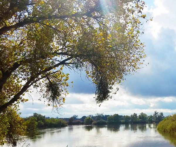
The views of the lake are stunning from Vista Grande.
Just like with other regional park and watershed hikes in the East Bay, hitting the trails in January or February will provide the visual treat of hills decked in the greenest green. Given Los Vaqueros watershed isn’t that far from Dublin, a hike this time of year will make you understand why Dublin was named after the Irish capital as the green hills rival any hill your eyes will feast on in Ireland when it comes to being vibrant green. It is made all the more impressive by oaks still in their naked winter grandeur dotting the hillsides.
Los Vaqueros is also considered by birding enthusiasts as one of the best places to bird watch in the Bay Area. Given it is part of the string of preserves, regional parks and state parks that has preserved the ridge of hills between the Livermore/Diablo valleys and the San Joaquin Valley it is easy to understand why that is the case.
The watershed is also home to a number of sensitive species including the San Joaquin kit fox, California tiger salamander, California red-legged frog, Alameda whip snake, and golden eagles. There’s a lot more wildlife including rattlesnakes as well as a creature that has an annual run at the watershed named after it — tarantulas — that make their presence known in the fall.
Make sure you carry water as there is none available along the trails. As far as trail makers, they are among the best and least confusing you’ll find especially compared to Mt. Diablo.
Several trails including Eagle Ridge connect to the adjoining trails in Round Valley Regional Park.
Fishing fees are $6 per day per angler. There are catfish, trout, striped bass, bluegill/sunfish, crappie and largemouth bass.
You cannot use your own boat — even a canoe or kayak — given the reservoir holds drinking water. That said the marina rents electric boats and pontoon boats when there are not COVID restrictions in place. There are also restrictions on bait.
Hours from November through February are 7 a.m. to 5 p.m., March 7 a.m. to 6 p.m., April through August 6 a.m. to 8 p.m., September 7 a.m. to 7 p.m., and October 7 a.m. to 6 p.m.
It should be noted the north entrance and south entrance are not connected although you can hike between the two. The day use fee is $6 per vehicle with a $1 discount for seniors.
For more information go to www.ccwater.com/losvaqueros.