POINT REYES — You can go practically anywhere in California to walk landscape shaped by earthquakes.
But if you want to stand on the proverbial bow of the ship in the style of Leonardo DiCaprio in “Titanic” it will take about a 95-mile drive from Manteca coupled with a 9.5 mile hike to Tomales Point through the tule elk preserve.
It is at the end of the hike where you can stand taking in incredible views of Tomales Bay, Bodega Bay, and the Pacific Ocean that will one day be at a point somewhere west of Oregon easily 100-plus miles in the middle of the ocean. Whether it is above water or below is up to the forces of nature that are continuously shaping the planet although at a pace that makes our lifetimes a fraction of a second in comparison.
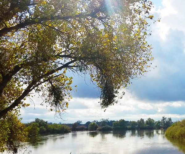
The San Andreas Fault runs right down the middle of Tomales Bay.
The eastern border of Point Reyes National Seashore parallels the fault. The national seashore is part of the Pacific Plate that is moving northwest from the North American Plate at a rate averaging 3 to 4 inches a year. Meanwhile the North American Plate is moving to the southwest at an average speed of 1 inch per year.
The movements are roughly at the speed your fingernails grow in a year.
Keep in mind the plates don’t creep along at a steady pace. Instead they lock together over the years building up tremendous pressure. When the plates slip the pressure is relaxed in the form of waves of energy resulting in earthquakes.
The last time the plates slipped in the Point Reyes area was in 1906 during the San Francisco quake. That largest movement in land in the area was 24.5 feet.
Geologists for years were baffled by how the rocks on the craggy peninsula matched rocks in the Tehachapi Mountains 310 miles to the south.
Those rocks — igneous in nature are granted and cooled beneath the surface of other rocks before erosion exposed them – originated 80 million to 100 million years ago in Southern California.
Those rocks started moving northward before the San Andreas Fault was formed and docked off of Point Lobos. That led to Point Reyes having six major sedimentary formations. Also, the unique forces means you will find all three basic rock types on earth — metamorphic and sedimentary as well as igneous — at Point Reyes.
There is an easier hike to take to gain a sense of the power of earthquakes in molding the topography. The 0.6 mile Earthquake Trail is a 20-minute that starts across from the Bear Valley Visitors Center.
There is a lot of nature to take in on the hike. But the most interesting feature from a quake perspective is the fence where a section moved 20 feet during the 1906 San Francisco Earthquake.
There are plenty of interpretive signs along the trail addressing the quake.
Despite Point Reyes being a national seashore that is constantly on the move, you will not see a single chasm, crack or other defining geological feature created by the San Andreas Fault. However, an aerial view beyond the peninsula looking south you can get an idea of how the fault likely created Tomales Bay.