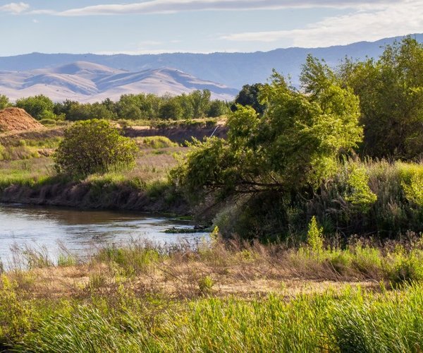
The 160,000-acre reservoir seen from the crest of the Black Hills Trail from perhaps 1,000 feet above looks like a perfect place for nature to have created a lake.
Rolling hills spread out from a wide bowl in the Northern Diablo Range.
But nature did not create Los Vaqueros. The Contra Costa Water District did.
The reservoir traces its roots back to the devastating drought of 1977. That’s when rising salinity levels triggered fresh water rationing to CCWD.
Established in 1936, the CCWD serves nearly 550,000 people in Concord, Pleasant Hill, Walnut Creek, Clayton, Clyde, Pacheco, Port Costa, and Martinez.
The district takes water from the Sacramento-San Joaquin Delta at four locations including the Middle River and Old River on the San Joaquin.
The reservoir is an “off-line” storage facility much like the State Water Project’s San Luis Reservoir below Pacheco Pass and west of Los Banos/Santa Nella and the proposed Sites Reservoir in Colusa County.
As an off-channel reservoir that means river channels are not blocked with dams. It is considered a much more environmentally friendly option for fish and the overall river ecological system.
Off-line reservoirs in California typically function as storage of excess water flow during weather years with higher precipitation. That means above average water flows that would normally be sent into the ocean are partially captured as hedge against drier years.
Los Vaqueros does that but at its heart it was conceived as a way to provide clean drinking without a high salinity content. Pumping water from the Delta during the summer and fall especially in times of below average precipitation can yield water that is too salty.
Salinity issues are one of the core objections communities dependent directly on the Delta for water as well as underground aquifers such as the ones that Tracy, Lathrop, Manteca, and, Stockton draw from. During the 1991 drought due to the lack of fresh water seeping into underground water tables to keep ocean salinity at bay, increased salt levels in water wells were detected as far east as Jack Tone Road.
Los Vaqueros Reservoir was completed in 1988. The original $61 million, 192-foot dam required relocating Vasco Road by building 12.8 miles around the 19,300-acre watershed at a cost of $27 million. The dam for the reservoir that originally held 100,000 acre feet was completed in February 1988 and completely filled 11 months later.
An expansion project started in 2010 and completed in 2012 raised the dam height 34 feet to 224 feet. It increased the storage capacity 60 percent to 160,000 square feet. It also expanded recreational uses and stepped up habitat protection. The surface covers 1,400 acres and has an elevation at capacity is 524 feet.
Los Vaqueros is also where the next significant increase in California reservoir storage could be in place by 2028.
The $915 million project will raise the dam 55 feet to 273 feet. It would increase storage from 160,000 acre feet to 275,000 acre feet.
The project has the support of a number of environmental groups.
The expansion will also benefit 11 other water/irrigating districts serving cities from Santa Clara and Brentwood to San Francisco as those serving agriculture such as the San Luis Delta Mendota Water Authority and Byron Bethany Irrigation District.
It is designed over the course of a year to increase water supply reliability from 44,000 to 504,000 acre feet during dry periods. It also increased emergency environmental water supply critical to wildlife refuges south of the Delta from 50,000 to 790,000 acre feet. The project also will add emergency water supply storage for Bay Area agencies from 80,000 to 120,000 acre feet a year.
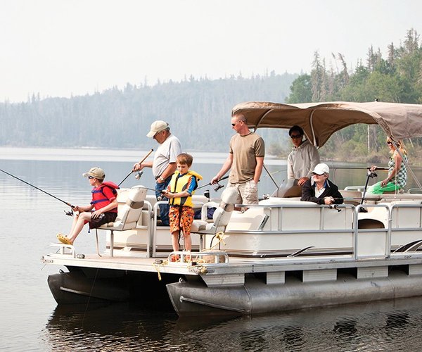
As designed it will further enhance recreation and wildfire protection in the Los Vaqueros watershed.