About 150 miles to the east of Manteca, Oakdale, and Turlock and over the Sierra ridge is one of the world’s largest active caldera volcanoes.
It is the 20- by 10-mile Long Valley Caldera that is adjacent to the Mammoth Mountain lava fields that some scientists believe has its own magma chamber.
Most of us never give volcanoes — the 900-pound gorillas historically when it comes to climate change —much thought. We tend to think of them as being in the South Pacific, on Iceland, in Alaska, Hawaii, or some rugged isolated Latin American mountain range.
We also think all volcanoes look like Mauna Kea in Hawaii taking in the shape of a giant cone. While there are three basic types of volcanoes — shields with board and gentle slopes, cinders cones that are steeped sides, and composites or strato-volcanoes that geologists recognize — they create four general shapes that have less to do with how lava is deposited as the physical shapes that are easier to recognize. They are the soaring volcano cones, volcanic craters, calderas that are essentially big basins created from a volcanic explosion and non-descript lava dome complexes or fields.
You can find all types in California as we are part of the Pacific Rim of Fire. California, as we define it, is a young part of the planet’s surface being molded daily by dozens of earthquakes far below the surface we can’t feel that is helping push up the Sierra and sending everything west of the San Andreas Fault such as San Francisco and Los Angeles- northward.
There were 838 quakes in California during the week ending Nov. 24. According to the United States Geological Survey that includes 8 quakes of magnitude 3.0 or above and 59 quakes between 2.0 and 3.0. There were also 771 quakes below magnitude 2.0 which people don’t normally feel.
The 2019 USGS’ assessment of volcanic hazards in California has created a bit of a buzz. The assessment determined there is a 16 percent chance that one of the state’s active volcanoes will erupt in the next 30 years. Active, by the way, doesn’t reference simply an eruption but also refers to lava movement below the surface. On that list is the Long Valley Caldera that Highway 120 east of Highway 395 runs along its northern edge that by some estimates is the most dangerous of them all. The basin was created by its last eruption — a cataclysmic explosion 767,700 years ago.
There have been at least 10 volcanic eruptions in California during the past 10,000 years. The last was Mt. Lassen that erupted between 1914 and 1917. Before that it was Mt. Lassen’s more prominent neighbor in the Cascade Range in the far reaches of Northern California — Mt. Shasta. Its last eruption was in 1786. The 14,179-foot high peak — the second tallest volcano in the Cascade Range that stretches northward to the Canadian border — is “the” volcano in California given its 9,772-foot prominence — basically the unobstructed view — that can be seen on a clear winter day after the winds have cleared the valley of pollutants from as far south as Sacramento and from the 3,848-foot summit of Mt. Diablo that towers above the northern most segment of the San Joaquin Valley.
Of the eight active volcanoes on the USGC watch list, three are relatively easy to explore — Long Valley, Mt. Lassen, and Ubehebe Craters in Death Valley. Mt. Shasta is the easiest to see and you can reach the summit but it takes a bit of fortitude and somewhat sharpened hiking skills. A fifth volcanic area that is still active but isn’t considered a major threat due to its size and is close by that you can explore is the Mono Craters volcanic field east of Yosemite and north of Long Valley. The Mono Craters last erupted 700 years ago.
The following are about visiting the five volcanoes mentioned above.
Long Valley Caldera
& Mono Craters
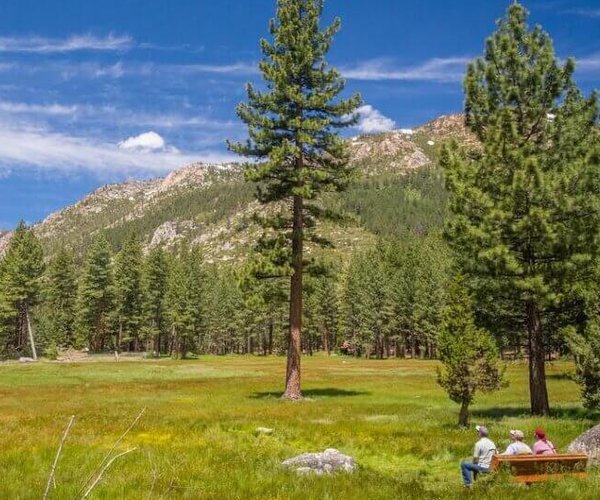
You can reach the Long Valley Caldera within a 3½ mile drive when Tioga Pass is open. If you’ve driven to Mammoth Lakes via Highway 395 after crossing the Sierra via Highway 120, you have driven through part of the caldera but not over the most active point.
It was created in an eruption 767,700 years ago that was 2,500 times greater than the Mt. St. Helens eruption in 1980. The explosion blew 150 square miles of earth skyward. Ash was sent as far east as Nebraska. It collapsed 200 square miles of earth into a deep depression
To be honest driving across it on Highway 395 doesn’t give you a feel for it as it seems just like any other basin. There are endless geological features that you can access by dirt road and a bit of hiking you can explore.
Or you can take a challenging hike to the top of Glass Mountain that is covered with black obsidian rock (volcanic glass) that many Native Indian tribes employed to make spears and arrowhead due to its natural forming sharp edges.
From its 11,185-foot summit that is the highest point on the caldera rim you can make out the basin the explosion created plus get an unparalleled view of Mono Lake, the eastern edge of Yosemite National Park and the eastern Sierra.
It is without a doubt my favorite short hike of all time. It’s a 2.6-mile round trip with a gain of 1,865 feet covering steep and often unstable ground earning it a “very strenuous” rating but the view and geology is worth every foot.
The trailhead is accessible by well-maintained dirt roads off of Highway 120.
The earthquake activity in the area increased significantly after 1978 prompting stepped up monitoring. Four magnitude 6 quakes shook the area in 1980 that created a dome-like swelling in the middle of the Long Valley Caldera. It started swelling by about a foot annually and then in early 2000 pushed the ground up 2.5 feet over a 100 square mile area due to new magna rising far below the surface.
There are numerous hot springs throughout the caldera. The easiest to access complete with funky hot tubs such as old bathtubs you can camp at are found in Benton Springs right off State Route 120 just west of its eastern terminus at the junction with US Highway 6.
The Mono Craters are next door just north of the Long Valley Caldera and are accessible by hiking from the Highway 120 segment that runs from Lee Vining to Benton but is closed in the winter.
A string of six volcanic craters known as Mono Craters are south of the 120 and Panum Crater is north of the highway just before the entrance to the South Tufa Towers area along Mono Lake.
When Tioga Pass is open it’s a long but do-able day trip that can include stops at Tenaya Lake Tuolumne Meadows right along the route to the Yosemite high country, Tioga Lake outside the park’s eastern entrance, as well as exploring the eerie looking tufa towers — created from fresh water pushing limestone up from the bottom of Mono Lake.
The lake, that has a higher salt content than the ocean, created more than 760,000 years ago, was part of a body of water that once covered much of what is now Nevada. It is considered one of the oldest lakes in the United States.
Ubehebe Crater
In Death Valley
Located in the northern part of Death Valley, Ubehebe Crater is 600 feet deep and a half mile wide.
It is the largest of a series of craters close together and was created possibly as recent as 300 years ago.
The rim of the crater is easily accessible as you can park nearby. The 1.5-mile round trip around the rim is moderately strenuous because of a sharp initial climb.
Hiking into the crater is easy; getting out can take its toll on you but it is doable.
While the Mono Craters are in the middle of raised cones, the craters in Death Valley are sunken.
It’s a seven-hour plus drive to Death Valley but seeing the crater is a good excuse to spend a couple of days there viewing the unique landscape before things start heating up in April.
Believe it or not there are endless wildflowers that time of year on parts of the valley floor.
Mt. Lassen
& Mt. Shasta
Mt. Shasta is the most high profile California volcano and is 278 miles or four and a half hours from Manteca via Interstate 5.
You can reach the summit with some serious hiking. Covering the last stretch takes three to six hours to go five miles with numerous switchbacks for a 2,000-foot gain but that’s after you’ve hiked three miles from the closest trailhead to Hidden Valley for a gain of 2,300 feet. Keep in mind in a normal snow year it is wise to wait until June or July to try and summit as the ridge route can be treacherous under normal conditions. There are several glaciers near the summit.
That said your best bet to “climb” a volcano in California that looks like the stereotypical volcano to many people is to head east of Redding to Lassen Volcanic National Park just over four hours from Manteca.
Lassen Peak’s plug dome volcano is considered the most likely to erupt in the Cascades over the next 100 years. You can see plenty of hydro- and geothermal activity in the park.
There are 150 miles of hiking trails in the park ranging from easy to strenuous.
The hike to the summit of Mt. Lassen at 10,457 feet is five-mile round trip that is strenuous but do-able for most especially if you take a leisurely pace. Park rangers say it can be an enjoyable family experience if you slow it down and turn it into a six hour outing.
It is considered an exceptional hiking experience during full moons.
It is also the only volcano you can summit where you can get a commanding view and shot of another volcano —the nearby and much higher Mt. Shasta to the west.
Lassen — which is open year round — receives about 500,000 visitors a year or an eighth of Yosemite. There is a lot of territory to explore and the Cascade Range has a different look than the Sierra. There are camping areas.
The nearest place to stay with a lot of activities is Redding where the famous Dial Bridge — designed as a functioning sun dial spans the Sacramento River below Shasta Dam.