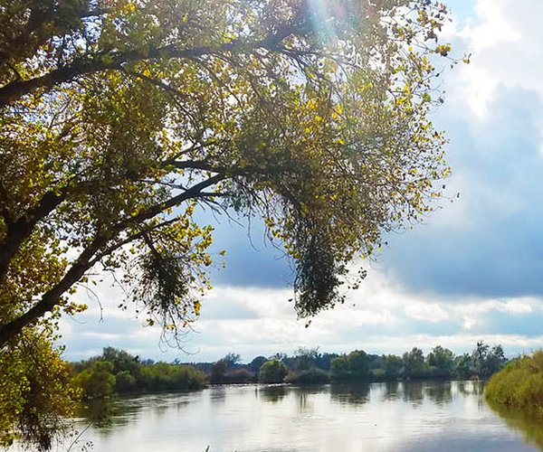
LONE PINE — Mt. Whitney was just what the doctor ordered.
The doctor happened to be Mike Davis, a Manteca pulmonologist.
I was never a patient but he gave me one of the most effective prescriptions I’ve ever received which was joining him for a hike up Mt. Whitney.
He convinced me to do so after a 6 a.m. step class complete with weights led by Linda Plooh at In Shape back in 1993. His pitch was that I hadn’t lived until I’ve tackled the summit of Mt. Whitney that at 14,505 feet is the highest point in the continental United States.
At the time I was 33 years old and into bicycle riding so much that I was hitting 10,000 miles a year. Hiking was something that had never crossed my mind. I had no idea what to expect. Mike made it so sound doable by noting as a teen growing up in San Francisco he hiked the trail. To be honest, it was do-able — eventually.
Our first ascent was stopped by deep snow covering the trail halfway up the 97 switchbacks heading up from the base camp area for those attempting two-day ascents. The base camp is located on an exposed, flat area of rocks just past the 10,000-foot mark. Just ahead was a short segment of safety railing, the only such “barrier” on the entire 10.7-mile trail on the way up, and it was leaning at an 80-degree angle over a drop of perhaps 800 feet having been pushed that way by the force of the snow that had piled up on the trail.
An active duty Army Ranger on a two-week leave who had been hiking behind us plowed on. In fairness, he was equipped for it as he had ice crampons and hiking poles with rugged hiking gear. I was dressed in Docker shorts, a short sleeve shirt, a hoodie, jacket, and cross-trainers that I wore to the gym.
My reply to Mike was fairly idiotic in retrospect given I was more than a little unsure what I had gotten myself into. I told him I had no problem continuing.
Fortunately his son Seth who was 16 years old at the time and a Boy Scout to boot was the voice of reason. When his dad asked him, Seth replied with a polite version of “hell no.” That did it for me. If a 16-year-old thought this was a bit over the top, that was more than enlightening enough for me. Almost everyone on the trail that day turned back.
Five trips to Whitney,
three all the way up
The next year I finally summited Mt. Whitney. It was also the year that I came within an inch or two of killing myself — more about that later.
I’ve tackled Mt. Whitney five times in the last 30 years making it to the top three times. The other failure was when I took my nephew Garrison up the first time. I wasn’t physically having a good time that day thanks to freezing temperatures and he looked like a 15-year-old on a death march given it was our third substantial hike in three days. I acted like the adult and told Garrison after we reached the foot of the switchbacks that I wasn’t feeling too good. He eagerly agreed to turn back.
None of this is meant to scare you off. That — along with my near death experience is designed to warn you to know your limitations based on weather, trail conditions, and taking others with you into consideration — as well as being properly prepared with supplies such as water, food, and first-aid equipment regardless of where you hike.
I’d recommend the hike to anyone who is in good health and reasonable shape that wants an experience they will remember — and inspire them — for a lifetime.
Keep in mind Mt. Whitney was my first hike ever of any consequence. It was also my second hike when we returned the following year to make it to the top of California and the 48 contiguous states.
The first time I drove from Manteca to Whitney Portal at 8,360 feet where Mike and others in the group — mostly Scouts and their leaders from Manteca were camping — some 13 miles west of Lone Pine. I got there at 6 p.m. and immediately went to sleep in my S10 Blazer as they wanted to head out at midnight. The second time it was a repeat except Mike and his teen son and daughter and I all came up in the Blazer. They camped, I slept in the Blazer, and we got on the trail at 2 a.m.
After that I decided to ditch the drive up, hike, and drive back routine after we got pulled over on the way home outside of Bishop by an Inyo County Sheriff who thought I was driving under the influence. After a late dinner in Bishop I was fine until we were in the west side of Tuolumne Meadows and I woke Mike up because I had a real fear I was about to fall asleep from total exhaustion. Mike drove us back to Manteca. This is also the hike where I almost killed myself — again, more about that later.
The other three times was a number of years later when I got into hiking. By then I was smart enough to book a motel room either in Lone Pine or nearby, drive up early enough, get in sleep so we could climb in the car at 1 a.m. to be on the trail by 2 a.m. and then go back to the motel room for the night.
Net elevation gain on
hike is twice that of
Mt. Diablo’s summit
The trail from the portal is well-maintained and not overwhelming. It is considered strenuous because for those who do it in one day it means a net gain of 6,137 feet — twice the elevation of Mt. Diablo — and a 21.4 mile round trip. With a 2 a.m. start time twice we made it back to the car before 5 p.m. after reaching the summit. On the second trip that I was under a bit of physical and mental duress — again more later — it was closer to 7:30 a.m.
The only drawback to the hike as far as I’m concerned is the people. It is limited to 100 a day for day use and 60 a day for overnight use because of the sheer number of people who want to tackle the summit. There are only two other 14,000 plus peaks in California you can do as a day hike and I’ve done both — White Mountain and Mt. Dana —but they aren’t quite as lofty as Mt. Whitney.
This means you need to get into a lottery to secure trail passes and a date. Unclaimed trail passes and dates are available via a website after May 1. If you think you’re going to get on the hike without a trail pass for that valid day, guess again. Rangers routinely hike the route checking for proper trail passes. They will send you packing back down if they catch you. The strict enforcement is needed because the environment doesn’t take too well to abuse or excess use.
The effort to secure trail passes as well as the drive and the 21.4-mile hike are worth the effort.
The first time I crested the ridge after the 97 switchbacks at about the 12,000-foot level I stood there and stared dumbstruck at the stunning beauty of the backside of Sequoia National Park where a distinct solid tree line gave way to granite terrain below.
My favorite summiting was my third time making it all the way to the top.
Hiking in 100 degree heat
in Death Valley and then
the next day hiking in a slight
Mt. Whitney snow fall
I was on a school seven-day hiking trip with my nephew Garrison who was 17 at the time — two years older than our first aborted attempt. The day before we had gotten up at midnight while staying in Stovepipe Wells in Death Valley to go in a one-way 4.1-mile cross country hike to the Panamint Sand Dunes after driving down what can best be described as a semi-primitive 9 mile road where if you were able to top 10 mph you were going too fast for conditions. We started that hike at 1:30 a.m. when the air temperature had cooled to 96 degrees. By the time we got back to the car at 9 a.m. it was 105 degrees. The ground temperature was much worse.
The sunrise that day was brutal and beautiful.
Seventeen hours later we were starting our Mr. Whitney hike at 2 a.m. at 8,300 feet with the air temperature a chilly 42 degrees. By the time we neared base camp at 10,000 feet just before dawn it was snowing.
As we made our way up the west side of the ridge line toward the summit the snow had stopped. As we reached the 14,000-foot mark we were literally walking into the clouds. Then perhaps 100 feet before the summit plateau, we hiked out of the clouds and into skies that were bright blue with fluffier white clouds above. It was as surreal as you could get. A thermometer said it was 44 degrees but it felt colder thanks to the wind that had absolutely nothing to slow it down.
It was then that Garrison stripped down to a tank top with the name of his school and its mascot, the Lincoln High Zebras, on the front. He then reached into his backpack and got out a “Zebra Zoo” flag that is the banner of the student cheer section, tied it to a hiking pole and told me to take his picture as he stood on the summit with the flag waving. People around us who were bundled up like Eskimos looked on as if he were crazy. (Hey, he’s a blood relative, what can I say?)
He planned to submit it as his senior activity photo for the El Eco yearbook.
As he was shivering putting on his hiking shirt and jacket I told him he was crazy.
He grinned like the Cheshire cat and told me he wasn’t as crazy as me and that if the truth be told the view from the summit was crazier as in “crazy beautiful.”
I looked around and there was what looked like an endless sea of granite mountains in all directions peeking out between cloud cover while blue skies were above us. It was indeed crazy beautiful.
Now about my close call.
Falling an inch from the edge
and living to tell about it
I bring it up to emphasize not simply why you should constantly think about what you are doing when hiking but to illustrate the importance of never panicking when you are in a precarious situation.
It was on my second trip with Mike and his kids. I let an REI salesperson upsell me to a “new” style of hiking poles that adjusted by an internal twist and lock device inside the pole. The hiking pole, by the way, was eventually taken off the market.
On my way up the 97 switchbacks, one of the poles kept slipping despite my best efforts to lock it in place. At one point I gave up and shortened the pole and secured it to my backpack and continued toward the summit. I made it to the top 15 minutes behind Mike and crew because I fell behind trying to fix the hiking pole. They were getting cold so they headed down while I spent 10 minutes soaking in my first visit to the summit.
As I was heading back down I passed one of three areas along the ridge route that rock climbers refer as chimneys. Essentially they are gaps in the mountain ridge. Rock climbers use them to work their way higher up a mountain especially when the gap is the length of their bodies or less.
This chimney, if that is indeed the proper name for it, was perhaps six feet wide at the trail level. On the west edge of the trail that was four feet wide give or take a few inches was a drop off of perhaps 300 or so feet down toward the John Muir Trail. On the east side was a “chute” composed of rocks and boulders that slopes down to the base camp at around 10,000 feet for a net elevation drop of around 2,800 feet or so. Every year when heavy snow covers the chute someone manages to do the risky thing and tries to slide down it. There have been times when someone has hit a rock. The results aren’t good.
As I was passing the chimney, the renegade hiking pole suddenly extended, tangled with my legs and I went down face first.
It happened so fast I was stunned. After a few seconds I realized my leg was bleeding, my left foot was in pain, and my left hand hurt like hell.
I wriggled my shoulders a bit as the water I was carrying — I was using plastic water bottles and not the hiking water bladder I do now — had shifted to my right.
When I made a movement to get up, a loud voice behind me sternly said “stop” and told me to look to my right.
I did.
I realized I was literally on the edge with a small part of my shoulder hanging off the trail with nothing but air below it for 300 feet or so. I reached down to check as much of my left leg as I could reach which wasn’t much more than the upper thigh. I looked to my left and there was the chimney gap and I saw an older gentlemen standing five or so feet back against the mountain side. I then ever so calmly pulled myself up to the left while at the same time doing what I could with my upper body to shift the water weight to my left so I could be as steady as possible as I tried to get to my feet. I stopped when I felt my right knee touch the trail. And then, about 10 seconds later, I went for it. As I came up I ended up stumbling to my left. The older gentleman started moving toward me and then moved back as I literally stumbled into the mountainside while using the good hiking pole I still had to steady myself to prevent from falling to the right.
I ended up with my back to the mountain. I looked to my left and there were perhaps a half dozen people standing there including one lady who literally had her mouth hanging open. I looked straight ahead and saw nothing but the sky. I then peeked around the corner of the mountain and looked at the sharp slope drop off.
I then looked at the gentleman who then uttered three words I will never forget —“you’re damned lucky.”
It was then that I started shaking.
I won’t tell you what I wanted to do with the hiking poles when I returned them to REI but I did get my money back.
I’ve had other interesting situations, mostly on solo hikes primarily in Death Valley canyons and ridges. Thanks to being somewhat “chicken” — I won’t venture out without standard hiking poles even though some view them as crutches — the judicial use of hiking poles allowed me to make my way off a precarious perch where I had gotten on a rain-slicked ridge in the Funeral Mountains by easing myself down 100 or so feet of a slope that was pushing 50 degrees.
I mention this not to scare you from hiking but to make sure you are prepared for situations that can arise as well as to respect nature. It isn’t Disneyland but with how many of us go about venturing into it you’ve got to wonder whether we are arrogant, ignorant or both.
For the most part — meaning everywhere I hike but the canyons, mountains, as well as cross country in Death Valley — I stay on established trails unless I’m scrambling up a Class 2-3 peak that is doable without special gear or training.
Meysan Lake is a good
alternate if you don’t
score a pass for Whitney
Even my most precarious moments have helped build my confidence and help make me calmer.
My sister Mary, after telling me Garrison thought he was going to die half the time we were on my typical Eastern Sierra hikes that involve at least a minimum of 10 miles and 2,000 plus of elevation gain a day, said they were huge confidence builders for him and that his friends thought he was cool from the photos we took of him on wind-swept passes above 10,000 feet, hiking Death Valley, walking along remote waterfalls, and selfies of him with what looks like half of eternity below him.
One last thing about Mt. Whitney: If you can’t get a trail pass this year to access the summit trail, you can still enjoy a pleasant hike out of the Whitney Portal where there is camping and even home rentals. You can go a bit up the trail but not far.
Instead of doing that, though, I’d take the trail out of Whitney Portal and make the 11.2 mile round trip to Meysan Lake at just above 11,000 feet. It has a 3,500 foot elevation gain and it can be done in 7 to 10 hours.
Besides the fact there were only a handful of people we encountered on the trail, Meysan Lake gives you a stunning taste of what the world is like above the tree line at 11,000 feet in the Southern Sierra.
Personally the scenery is better than on the Mt. Whitney trail and you don’t have the feeling of being stuck in rush hour foot traffic. It is so peaceful that it makes my list of the best five places to nap as an excuse to go hiking on a trail that gets you a minimum of 2,000 feet in elevation gain.
Of course you can’t say that you hiked to the highest point in the contiguous 48 states but it is so worth the drive that I’m thinking about building my summer hiking trip this year to the Eastern Sierra around including the hike as one of my six ventures.
I’m not too sure if Mike hikes any more but him helping me get hooked on hiking is the best medicine for having a better life.